Visited the team of Ikatan Surveyor Indonesia (ISI), Institute of Technology Bandung (IBT)
The Ikatan Surveyor Indonesia (ISI), founded in 1972, is a surveying and mapping professional association. ISI plays an active role in the development of the surveyor profession in Indonesia and supports the role of the surveyor profession in national development and its headquarter is in Jakarta. The main work of the ISI is , (1) Terrestrial Survey for making regional maps、(2) Hydrographic Survey、(3) Aerial Photograph Survey、(4) Satellite Image Survey、(5) Cadastral Survey、(6) Geographic Information System (GIS).
The Institute of Technology Bandung (ITB) is one of Indonesia's public research universities, and it is also the country's oldest technological university. During the past two years, TIUL has also had a close partnership with ITB in research cooperation. In January 2023, the Center held a seminar with the Geodetic Society of the Republic of China on the development trend of international geodetic benchmarks and satellite geodesy, and conducted its first cooperation with Bandung University of Technology in Indonesia. At the cooperation conference, TIUL and ITB also discussed that in addition to continuing to hold relevant international measurement seminars, relevant ITB researchers could also be invited to Taiwan to exchange multi-level topics such as international measurement technology, environmental change issues caused by land development, disaster risk, and the rule of law in the future.
Therefore, on March, TIUL went to the Bandung Institute of Technology (ITB) in Bandung and visited the former director of the Surveying and Mapping Bureau , Prof. Heri Andreas, a professor of geodetic engineering at the School of Earth Science and Technology. And we also visited the Secretary General of the Ikatan Surveyor Indonesia (ISI), Amri Chatib and other members. Three teams of us shared the experience and achievements of Taiwan and Indonesia in space surveying and mapping technology together.
During the process, the Secretary General of the Ikatan Surveyor Indonesia, Amri Chatib, mentioned that the Indonesian government has attached great importance to the development of mapping infrastructure and human resources such as "National Base map" and "Disaster Management" in recent years. And he said the Indonesian Association of Surveyors was established in 1972, and currently has more than 6000 members. It is the only surveying organization in the country, with influence throughout the national surveying and mapping related industries. It is also a member of the International Federation of Surveyors (FIG). ISI has established the ISI Professional Certification Body (LSP) since 2017, which has been recognized by the National Accreditation Committee of Indonesia (KAN) and licensed by the National Professional Certification Agency (BNSP). Therefore, the Professional Accreditation Service (LPS) is an important institution for ISI to cultivate human resources in surveying and mapping. However, there is still a process in which professional certification procedures and structures need to be adjusted, and it is expected to learn from and draw on the experience of the Chinese Mapping Federation in Taiwan.
Dr. Hsuan-Chang Shi also mentioned, Taiwan has long been deeply engaged in the development of space surveying and mapping technology, and has accumulated considerable executive experience and technical strength. In the current, new trend of scientific and technological innovation and sharing, the industry, government, and academic circles in the field of Surveying and Mapping are very willing to share relevant technologies and achievements, and look forward to joint exchanges with partners in Indonesia and other ASEAN countries in the future.
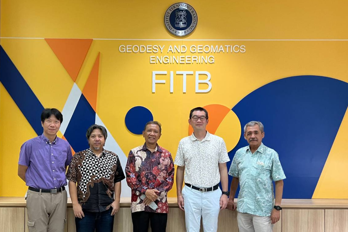
Visit the ITB team of Bandung Institute of Technology
Visited the Subsidence Observation Station along the Coast of North Jakarta
In 2018, the Indonesian Institute of Technology Bandung (ITB) published a research survey. According to this survey, the ground in North Jakarta has subsided by 2.5 meters in the past 10 years, which is more than twice the rate of subsidence in coastal cities around the world.
However, the subsidence problem is not unique to North Jakarta. In West Jakarta, the average subsidence is 15 cm per year, 10 cm per year in the east, 2 cm in the central part, and 1 cm in the south. On an overall scale, about 40% of Jakarta is now below sea level. Furthermore, according to model estimates, about 95% of the northern coastal land will be submerged by seawater by 2050.
Professor Heri Andreas, currently working in the Department of Geodetic Engineering, ITB’s Faculty of Earth Science and Technology, said: "Groundwater can be used by anyone, whether it is for domestic or industrial use. But the biggest problem in Jakarta is that the urban planning is not perfect, government officials have problems in implementation, and the government has not done a good job of supervision, which makes the people over-pump groundwater.
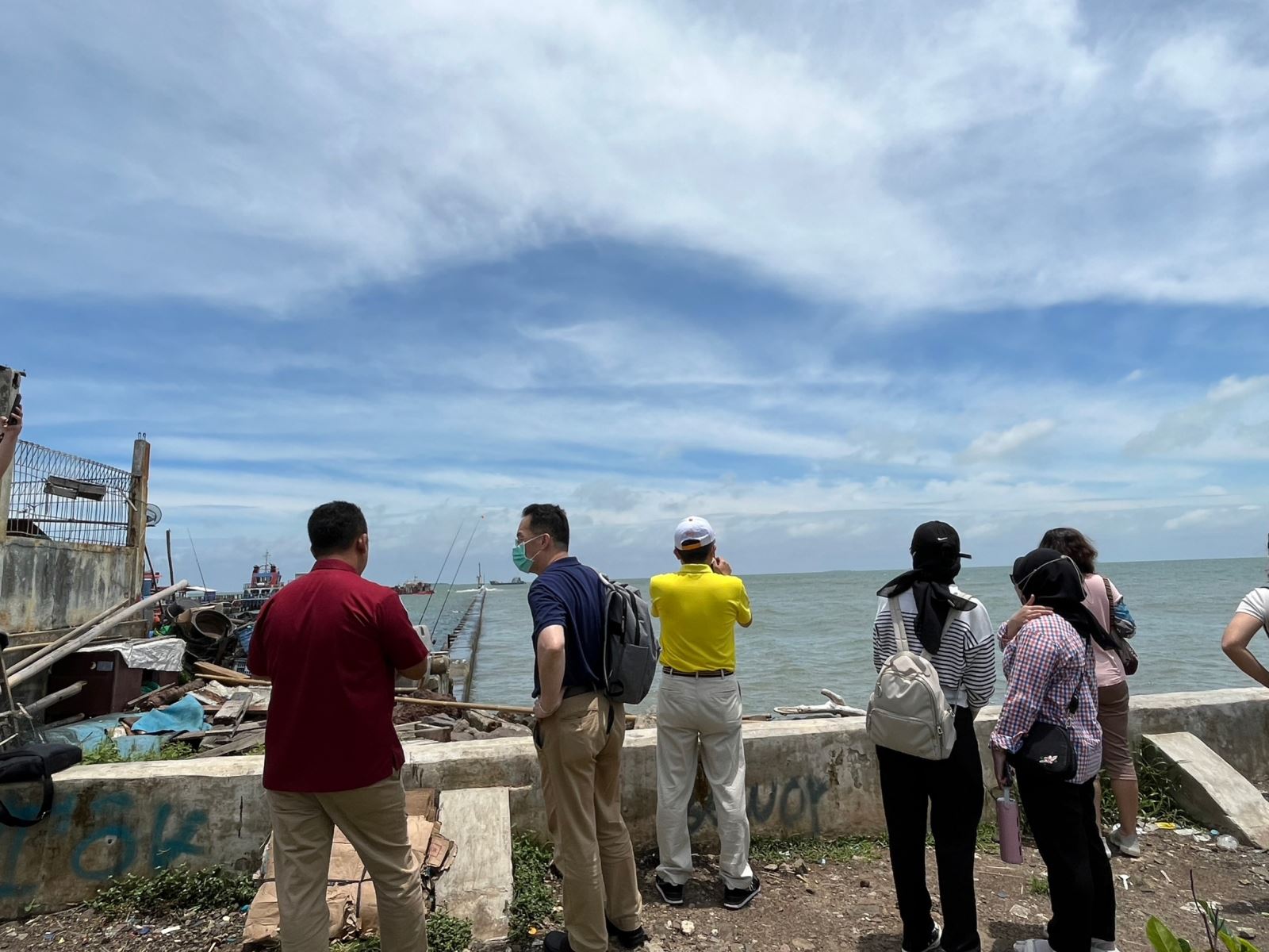
Therefore, our team also followed the ITB team to the Muara Baru and Ancol coastal subsidence measurement and observation stations in North Jakarta, and learned about the current problems of coastal subsidence and the local government's countermeasures. At first, we visited PPS Nizam Zachman Jakarta in Muara Baru, Jakarta, to investigate the local subsidence measurement observation stations and facilities, and to see the current status of coastal embankments in coastal areas.
Our team also went to the strata subsidence measurement and observation station in Ancol area together with ITB members to visit the strata subsidence monitoring and measurement equipment. Professor Heri Andreas introduced that in the past, the ITB used tidal data collection and processing, tidal instruments, measuring stations, and global navigation satellite system measurement equipment to collect data on stratum subsidence and sea level rise. Professor Heri Andreas believes that coastal flooding on the coast of Jakarta has become an important issue at present. If the disaster occurs, the economic consequences will reach hundreds of trillions of Indonesian rupiah. Therefore, adaptation and mitigation measures must be taken.
However, the current policy of the government to promote the construction of seawalls can only be used as a short-term measure, because the dams are gradually sinking, and in the end, the height of the dykes still needs to be continuously raised to prevent them from being submerged. An effective strategy should be that the government must popularize tap water supply as soon as possible, and legislate to control the extraction of deep groundwater, prepare alternative water sources in advance or stop exploiting groundwater, that is, conduct comprehensive resource management plans for land and water sources passing through the basin to obtain alternative water sources. At the same time, it is hoped that the government will pay more attention to the monitoring and early warning of strata subsidence and sea level rise, so as to achieve mitigation and adjustment strategies.
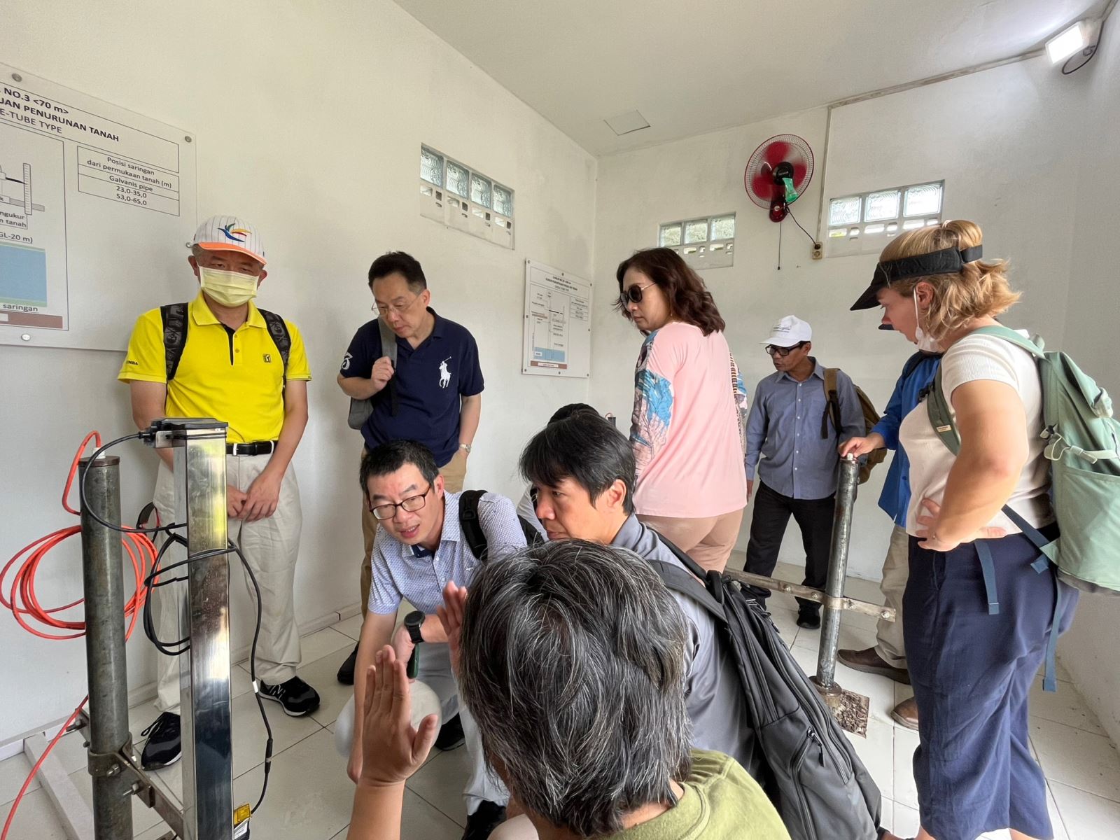
Visit the Muara Baru Stratigraphic Subsidence Observatory in Jakarta
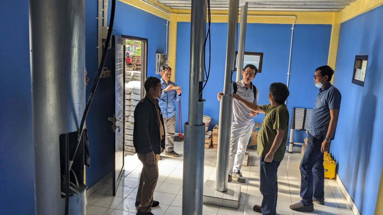
Visit the Annal Stratigraphic Subsidence Observatory in Jakarta
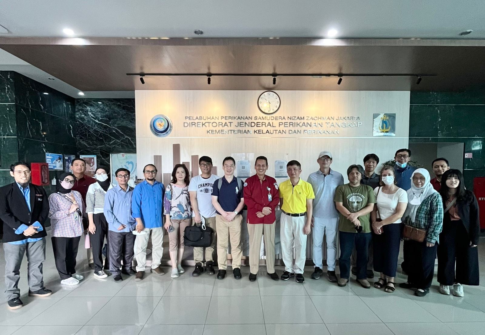
Visit to Muara Baru Distant-Water Fisheries Port Authority
Survey of the Current Situation of the Muara Baru Coastal Embankment